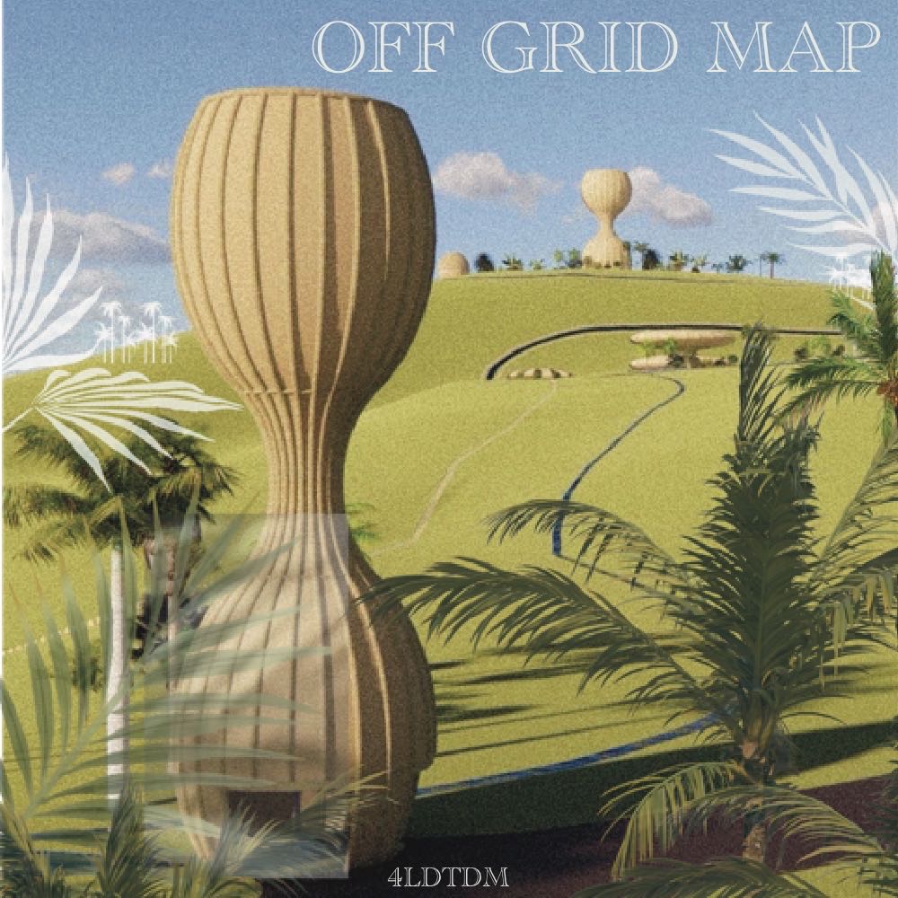
Off-Grid Map: A New Paradigm in Navigation
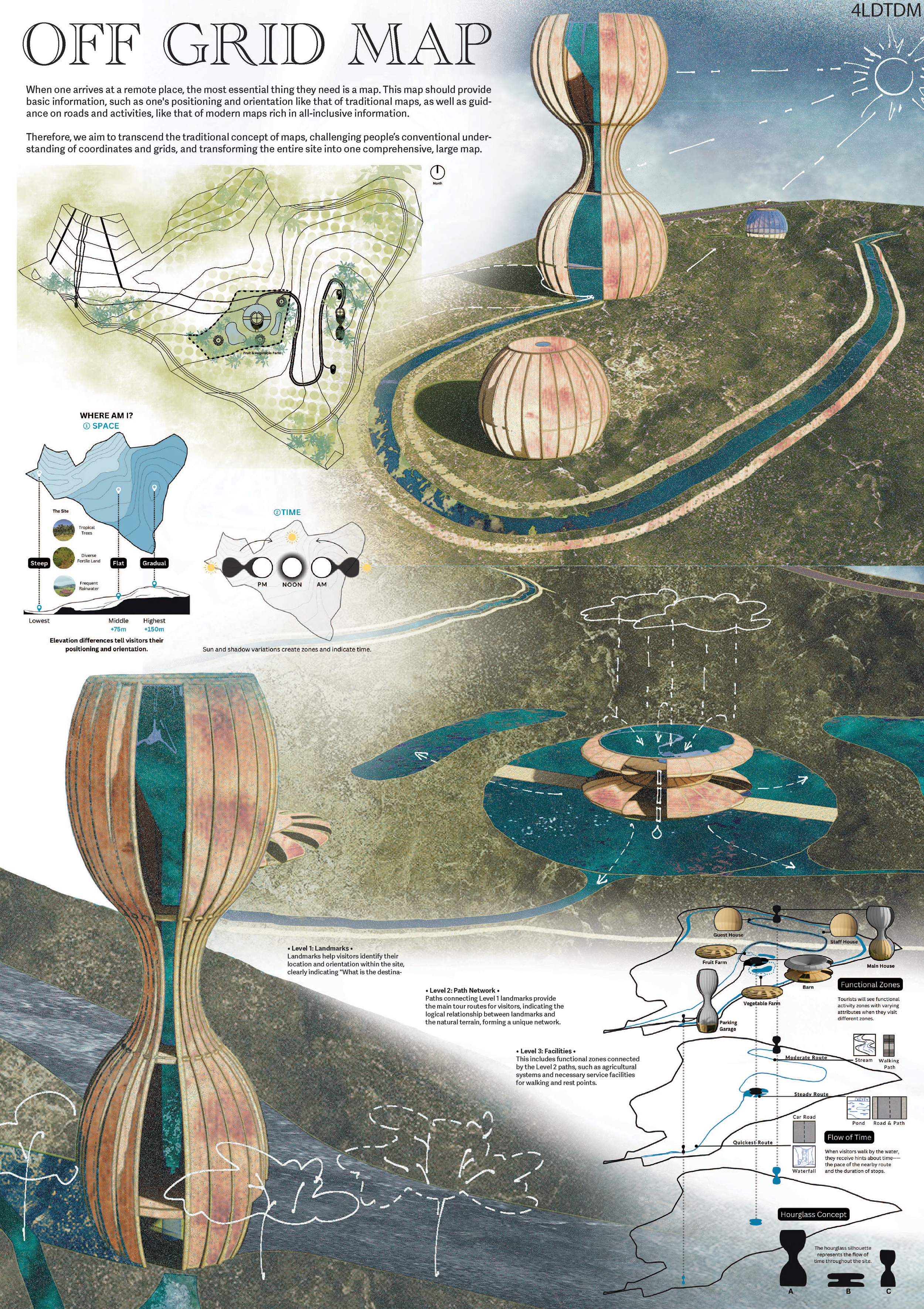
When arriving at a remote location, the most essential item one needs is a map. Our vision for the Off-Grid Map goes beyond the concept of traditional and modern maps by integrating comprehensive site-wide guidance, challenging conventional notions of coordinates and grids, and transforming the entire area into an interactive, large-scale map.
WHERE AM I?
① SPACE: Elevation changes help visitors understand their positioning and orientation within the site.
② TIME: Variations in sunlight and shadows create zones that indicate the time of day.
The venue is structured into three distinct levels, each providing information from the most important to the less important aspects of the site.
Landmarks serve as primary reference points, helping visitors identify their location and orientation. These landmarks answer the essential question: "What is the destination?" The hourglass concept represents the flow of time across the site, providing a unique temporal context.
Water bodies connecting the Level 1 landmarks outline the main routes for visitors. These paths highlight the logical relationship between landmarks and the natural terrain, creating a unique network. Visitors walking along these paths receive subtle hints about the time through the surrounding environment, such as the pace of the nearby routes and the duration of stops.
Functional zones connected by the Level 2 paths include agricultural systems and necessary service facilities for walking and resting. These zones offer varying activities and attributes, enriching the visitor experience.
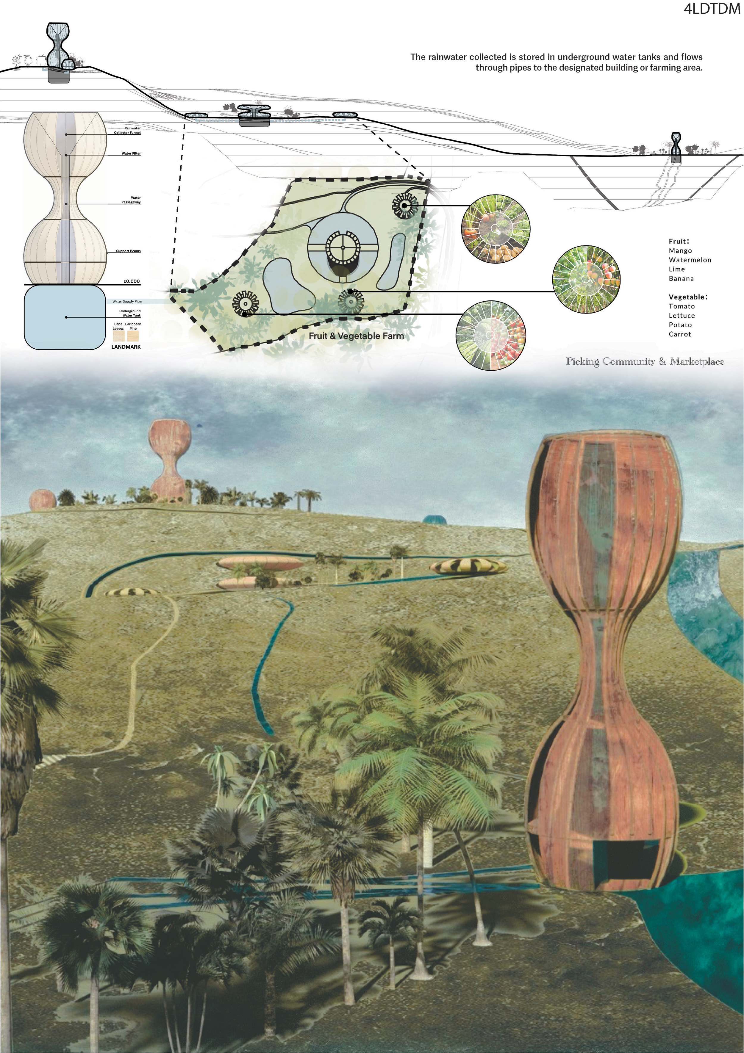
Sustainable Water Management
Rainwater collected is stored in underground water tanks and distributed through underground pipes to designated buildings or farming areas. This system ensures a sustainable and self-sufficient water supply.
Community Engagement
A picking community and marketplace offer local fruits and vegetables, fostering community engagement and supporting local agriculture.
The Off-Grid Map is designed to enhance the visitor experience by providing an intuitive, integrated navigation system that harmonizes with the natural environment. By transforming the entire site into a map, we offer a seamless blend of spatial and temporal orientation, sustainable infrastructure, and community involvement.